Just how long is it, anyway? That was the question the staff of At The Lake magazine pondered last summer. We had read and seen mileage estimates ranging from 20 to 27. When we stated in our own published guide that the path around Geneva Lake is just over 20 miles, were we correct? We decided that the path must be walked and detailed data be reported back.
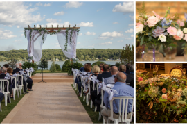
The public walking path around Geneva Lake is a footpath accessible to the public. It meanders along the shoreline, crossing the front lawns of lakefront estates, association beaches and public parks. The terrain varies from grass to dirt to brick and concrete, hilly and wooded, sometimes soggy. It’s meant for walkers (no strollers, bikes, etc. — see sidebar on page 72) and is one of the most picturesque paths around, in our opinion. There are several printed guides available to tell you the history of the many estates around the lake, in fact, we publish one of them.
Our office has always fielded questions about the path. Just how many miles is the shore path, exactly? What are the best starting and ending locations? Where are the bathrooms?
So last summer and again this spring, several of our staff volunteered to walk segments of the shore path and keep track of mileage, walking time and a lengthy list of path questions. One staff member, Jerriann Mullen, decided to knock it out in just one day.
JUST A DAY TRIP?
Jerri chose a sunny and warm August day for her walk. She said she wanted to meet a personal goal of walking the path all in one day, because so many people do that every year. And to be honest, even in her 14 years of living here, she had never experienced the entire path, just certain segments.
Jerri started out in Williams Bay at 7 a.m. According to her Garmin Forerunner Running GPS, it took her 7 hours and 23 minutes to circle the lake, with a total mileage of 21.56. She finished at 2:45 p.m. (she paused the clock when she stopped for a lunch break). She averaged an 18-minute mile in the beginning, and by the end she was walking about a 22-minute mile.
That seemed fast to us (we had heard 8 to 10 hours was a more reasonable walking time), so we asked around. It turns out that although Jerri walked at a brisk pace, she didn’t set a record. In 1981, long-time Geneva Lake Museum curator Helen Brandt walked it in 6 hours, 22 minutes. “I started on a Sunday morning in October, before dawn, with a flashlight,” she remembers. “I always took water and my Snickers bars — they accompany me on every walk. I also took my shillelagh in case I encountered any unfriendly dogs.”
What’s a shillelagh? we asked. It’s an Irish walking stick that can be used as a club. Helen reminded us there were no cell phones back then, so she needed some sort of self-defense plan as a single walker out alone on the path.
All told, Helen walked the entire shore path in a day seven times that year, and was proud of her accomplishment (she should be!). But then she found out about Mark Baumbach.
THE RECORD HOLDER
As a summer resident in Cedar Point Park, Mark and his friends always walked or ran around the lake at least once every summer. But in 1970, they literally stepped it up.
After seeing the movie “Cool Hand Luke,” in which Paul Newman is challenged to eat 50 hard-boiled eggs in one hour, Mark and his friend Jim Bowman wondered what kind of challenge they could come up with for the summer. They agreed upon a plan to run around the lake twice in one day.
“We started at three or four in the morning, with flashlights, and we thought we could do the first round in seven or eight hours and even just walk the second round,” Mark recalls. “We finished the first round in seven hours, and I think it took us eight to 10 hours the second time around — and was not as much fun. I was sore and hurting from Lake Geneva to Cedar Point, and when we finished, I took a hot bath.”
THE READER’S TURN
Because every walker is different, and you may not want to walk or run the shore path all in one day, we have separated Jerri’s report on the shore path by section, so you can choose for yourself which section(s) to walk and whether you want to take on the entire path in a day.
As mentioned, Jerri used a Garmin Forerunner Running GPS to keep track of mileage. Other At The Lake staffers used different devices or smartphone apps to compare with the Garmin’s measurements. In most cases, measurements were consistent, and those device results are also reported for each section.
WILLIAMS BAY TO FONTANA
Mileage from western edge of Edgewater Park to Chuck’s Lakeshore Inn in Fontana: 3.31 miles measured by the Garmin, 3.17 miles measured by a Fitbit.
Walking time: about an hour and 15 minutes
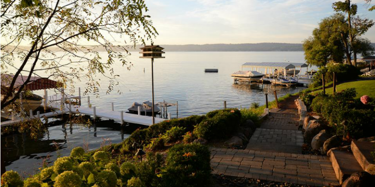
This segment has easy terrain, Jerri reported. She crossed paths with many early-morning runners. She parked at Edgewater Park for the day (free) and started her pedometer at the pergola (see photo above). This segment winds around several lakefront camps, including George Williams College of Aurora University, which has an ice cream shop open during the summer and a very picturesque lakefront. Winding closer to Fontana, expect some curving, wooded paths close to the lakeshore and a few newly-constructed estates.
The path also winds around 552 feet of undeveloped lake frontage owned by Yerkes Observatory (the University of Chicago).
When you reach Fontana, there are public restrooms near the playground in Reid Park. There are also several bar/restaurant options, including Gordy’s and Chuck’s, and places to sit in the park. Fontana also has a metered parking lot and places to be picked up or dropped off.
FONTANA TO SHADOW LANE
Mileage from Chuck’s Lakeshore Inn to Shadow Lane (just before the start of South Shore Club): 2.69 miles measured by the Garmin, 2.60 using the Map My Run smartphone app.
Walking time: about an hour
Use the restrooms or stop for food in Fontana, because there aren’t any public places along this segment. Starting out, Jerri found it easier to walk in the grassy area behind the beach in Fontana until she got back along the shoreline.
Shadow Lane is best as a drop off point, but you can park cars toward the top of the hill.
There are some quaint associations along this segment and some larger, historic estates. If you are walking in the summer, you may spot the 63-foot Benjamin Bates docked just past the Indian Hills subdivision. Peter Bates designed it in 1991 and named it after his great-great-grandfather.
At the end of this segment is a stone marker commemorating the former site of the Northwestern Military and Naval Academy, which operated here from 1915 to 1995, when it merged with St. John’s Military Academy in Delafield. Today the subdivision is known as South Shore Club.
SHADOW LANE TO BIG FOOT BEACH
Mileage from start of South Shore Club to first “No Lifeguard on Duty” sign at Big Foot Beach: 6.39 miles measured by the Garmin (NOTE: in cooler months, the sign is removed and only the pole remains).
Walking time: Just over 2 hours at a good, consistent pace
Jerri liked the rustic, woodsy portions of this segment; she found it peaceful and secluded. But it is a long stretch. Fortunately there are usually Porta-Potties available at Linn Pier Road, as well as a parking area if you decide to call for a ride.
The Historic Black Point Estate is located near the start of this segment, but can’t be fully seen from the shore path. You’ll see the staircase (about 100 steps) that connects the boat dock with the estate. Tours of the home are available through the Lake Geneva Cruise Line.
Signage will direct you around Trinke Estates, because a lagoon and swampland prevents walking close to the shoreline.
BIG FOOT BEACH TO LAKE GENEVA
Mileage from first “No Lifeguard on Duty” sign at Big Foot Beach to fountain in front of Riviera: 1.93 miles measured by the Garmin, 2.12 using the Map My Run smartphone app.
Walking time: just under an hour.
Use caution when walking along the highway and Big Foot Beach. For a quick break, walkers can access the state park restrooms and picnic tables (vehicles require a state park sticker). The lagoon in the park is a replica of Geneva Lake and was created by the Maytags (of washing machine fame) when they owned the property.
As you get closer to Lake Geneva, the Expect a Miracle Mansion is a great spot to slow down. The path in front of the house features a white fence painted with inspirational quotes. Thousands of walkers have signed the notebooks that are available on the path. As of press time, this estate was still for sale, priced at $7.4 million.
LAKE GENEVA TO CHAPIN ROAD
Mileage from fountain in front of Lake Geneva to Chapin Road: 3.74 miles measured by the Garmin, 4.13 miles measured by a Sportline pedometer (includes some backtracking to go back and take photos).
Walking time: about one hour 15 minutes
Before you leave Lake Geneva, there are restrooms at both ends of Library Park and in the Riviera building. If you’re not getting picked up at Chapin Road, the walk to the next public area will take close to three hours, so make sure to plan accordingly. Like Shadow Lane, Chapin Road is an easy pick-up or drop-off point.
You’ll see some huge estates along this segment, along with varied terrain, some steep stairs and hills. The Wrigley property is along this stretch, and also Glanworth Gardens, the sprawling estate of Richard H. Driehaus.
In the lakeside front lawn of Bonnie Brae are more than a dozen metal sculptures by artist Joseph Kinnebrew. Some pieces are available for purchase (visit www.josephkinnebrew.com for more information).
CHAPIN ROAD TO WILLIAMS BAY
Mileage from Chapin Road to pergola at end of Edgewater Park in Williams Bay: 3.5 miles measured by the Garmin, 3.87 measured by a Sportline pedometer, 3.57 measured by the Cardio Trainer smartphone app.
Walking time: about an hour and a half
This route ends with a downhill slope into Williams Bay. You’ll pass through a winding, shady subdivision called Elgin Club, with the oldest residence dating back to 1878.
The residence resembling Frank Lloyd Wright’s Fallingwater is often mistaken for a Wright design, but it is not. Its flat roofs, expansive windows and projecting balconies are all Wright-like but not quite Wright.
Cedar Point Park, the last area before the village park and beach, was founded in the 1920s and where Mark Baumbach began his challenging double-run around the lake, 44 years ago. Any takers for 2014?